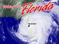
Excerpts from The Handbook for Roving Hurricane Correspondents:
Welcome to the exciting world of hurricane journalism!
While your highly paid colleagues on the anchor desk are broadcasting from the dry safety of a heavily fortified television studio, you and your camera crew will be out in the maw of the storm, risking your lives for no good reason.
• What you should wear: Always choose the flimsiest rain jacket available, to visually dramatize the effect of strong winds. All foul-weather gear should be brightly colored in the event you're swept out to sea or sucked down a drainage culvert, and someone actually goes searching for you.
• What you should televise: The first rule of hurricane coverage is that every broadcast must begin with palm trees bending in the wind. Never mind that the puniest summer squall can send a coconut palm into convulsions, your producer will demand this meaningless shot.
Once the storm begins, you can forget about swaying palm trees and concentrate on ficus, banyans, oaks and Austrialian pines -- the ones that actually go down.
Fallen-tree video is absolutely essential to hurricane broadcasts. The most sought-after footage is, in order of ratings:
1. Big tree on strip mall.
2. Big tree on house.
3. Big tree on car.
4. Small tree on car.
5. Assorted shrubbery on car.
Note: The Hurricane Broadcasters Code of Ethics forbids correspondents from purposely knocking down any native vegetation with a TV satellite truck to simulate weather damage.
• Where you should go: The days before a hurricane are the most challenging for roving correspondents, because not much is happening. Needless to say, if you've got a choice between hanging out at the local Home Depot or cruising the beach, head immediately for the surf.
When the storm finally comes ashore, always stand dangerously near the rough water and position yourself so that the spray hits you directly in the face. If it's not raining yet, take off your hood and let the wind mess up your hair.
Remember: A wet, tired and weather-beaten appearance is crucial to your credibility as a hurricane journalist.
• What you should say: When covering a hurricane, there's no such thing as overstating the obvious. And, let's face it, how many different ways can you say it's rainy, windy and miserable?
To break the monotony, you might take a guess at how high the ''storm surge'' will be, even though you won't have a clue. Tedious lulls in the action will also offer the opportunity to ramble on about ''feeder bands,'' which is the slick new term for squall lines.
And when the dry, well-fed anchorfolks back in the air-conditioned studio ask you to sum up the situation in your location, always say the following:
``Conditions are deteriorating, Dwight.''
• Whom should you interview: As a hurricane advances, it's standard procedure to chat with evacuees, hotel owners, utility workers and disappointed tourists.
The two mandatory video loops are (a) worried residents boarding up and (b) harried residents standing in long lines to purchase water, batteries and other supplies.
Once the storm is imminent and the coastlines are evacuated, your interview possibilities will be reduced to:
1. Police and emergency personnel who are out on the streets because it's their job.
2. Amateur ''storm chasers'' and other wandering dolts who wish to experience the force of a hurricane up-close and personal.
3. Surfers.
Of these, surfers are by far the most entertaining interview subjects for TV. Unfortunately, you could easily die trying to talk them out of the water.
• What to do when the hurricane actually strikes: Obviously the sensible move is to broadcast from the protected lee of a strong building, but for that you could get fired.
Your producer will instead order you to step into the teeth of the storm, where you risk being clobbered by flying glass, coconuts, shingles, patio furniture or surfboards.
This is an act of utter derangement, but it makes for amusing television. If you survive, your next mission will be to find and film a major piece of hurricane debris -- the money shot.
Remember, your viewers' expectations are high. They've watched that big slow mother whorling across the Doppler for a week, and they've been primed for devastation on a biblical scale.
Take no chances. Proceed immediately to the nearest trailer park, being extra careful not to crash into other TV crews on the way.
• What to do when the worst is over: A friendly reminder -- The Hurricane Broadcasters Code of Ethics strictly prohibits drinking on the air. However, only you and your camera crew need know what goes on in the privacy of the satellite truck. If anybody asks, you know what to say: ``Conditions are deteriorating, Dwight.''
borrowed from an article by Carl Hiassan in the Miami Herald.


